

We put together a list of the Best Mountain Bike Trails in Colorado, these are all easily accessible for the city and offer a great workout and even better scenery. Get on them now while temperatures are in your favor as these rides mid-summer can be brutal.
Ranch Mountain Bike Trail
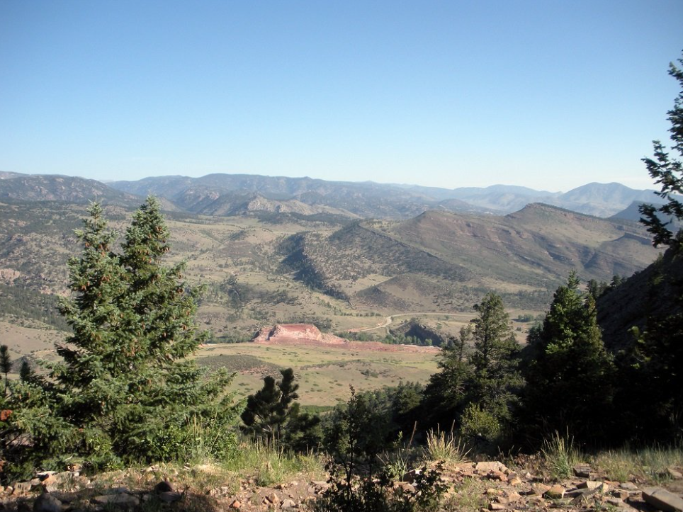
There are quite a few easy rides that you can start within the Boulder city limits, but if you want to get anything more than cruising done, you’re better off heading further out of town. And one of the first trails you come across on your way out of town (heading toward Lyons, anyway) is Heil Valley Ranch.
Heil Valley is actually a network of trails that includes the Wapiti Trail, the Picture Rock Trail, the Wild Turkey Trail, and the Ponderosa Loop. Wild Turkey and Ponderosa snake around the top of the ranch, while Wapiti and Picture Rock are ways to get up there from different locations (Wapiti from the Boulder side, Picture Rock from the Lyons side).
Picture Rock is a more pleasant way to get to the top of the system, though it’ll take you longer; at 5.5 miles one way, it’s a more leisurely and scenic ride. One of the best most scenic mtb trails Colorado’s front range has to offer. There’s some fun stuff to see, though you don’t get the cool views of the valley as you do from Wapiti. Both of the ascending trails have their pros and cons—I recommend riding them both and seeing which one you prefer.
Wild Turkey (2.9 miles one way) and Ponderosa Loop (2.6 miles) form a sort of figure-eight around the top of the ridge, and you can combine them for a decent number of miles. Because there’s not nearly as much elevation change as Wapiti or Picture Rock, these trails don’t take very long, but they’re a lot of fun to blast through a couple of times before heading back down. If you’re coming from Wapiti, you can choose to do just the Ponderosa Loop, or all of Wild Turkey plus about half of Ponderosa (you could also complete both trails if you retrace your steps a bit). If you’re coming from Picture Rock, you have to do at least half of Wild Turkey to get around.
If I were to rate the trails, I’d say that Wapiti is high-intermediate in difficulty, and the rest are intermediate. There’s nothing super technical out here, but Wapiti can be tough, both aerobically and technically, when it comes to the ascent. Don’t let that scare you, though—the descent is worth it.
Heil Valley Ranch is a small trail system, but for being only a few minutes out of downtown Boulder, it’s a great option for a quick ride after work or in the early morning. Not many people are out here during the week, but it can get a bit busier on the weekends. Also, because a lot of this is pretty exposed, I recommend riding early in the morning or late in the afternoon in the summer. It gets really hot up there.
Directions: Take 36 north out of Boulder. Turn left on Lefthand Canyon Dr. Turn right on Geer Canyon Dr. Take Geer Canyon all the way to the trailhead.
Chimney Gulch to Apex Mountain Bike Trail

Clear out your winter lungs with a climb up Chimney Gulch and earn yourself a well-deserved descent on Apex Trail while you’re at it. You’ll be climbing the same hill as all those skinny tire folks heading up Lookout, but we think going up on the dirt is much more fun, and there are few front range descents that compare to Apex.
Take some time to enjoy the incredible views of Golden and Denver on your way up. Extend your descent by taking the Enchanted Forest or Pick n Sledge trails. Pay attention to trail signage as Apex is heavily traveled and the trail uses a one-way even and odd days system for trail users. Chimney Gulch trailhead has roadside parking on the west side of Highway 6, just north of 19th Ave.
Local Shop: Golden Bike Shop
Google Map: Chimney Gulch
Ridgeline Open Space Mountain Bike Trail
At only a couple years old, Ridgeline Open Space is one of the newest trails in the area. If you’re looking for smooth, fast, flowy single speed-friendly singletrack, you should make it a point to head down to Castle Rock for an afternoon on this nearly fifteen-mile network of trails.
There are multiple access points throughout the Meadows neighborhood, but most riders start in the Bison Park parking lot, near Foothills Drive and Clear Sky Way.
Local Shop: American Cycle Sport
Google Map: Ridgeline Open Space
Hall Ranch Mountain Bike Trail
A longtime favorite for front range riders of all abilities, Hall Ranch is consistently rideable year around. With easy access from Boulder, this trail sees a lot of traffic on the weekends. Climb up the Bitterbrush Trail to hit the challenging rock garden, or ride from town and climb up the forgiving Antelope Trail.
Take a couple of laps around the two-mile Nelson Loop, then drop back down Bitterbrush, through the rock garden. Connect with Heil and Picture Rock and make this an all-day ride!
Local Shop: Redstone Cyclery
Google Map: Hall Ranch
Mt Falcon Mountain Bike Trail
Oh, Mt Falcon, we love and hate you at the same time! Your forested upper singletrack on Devil’s Elbow and Parmalee make us smile, but your Castle Trail climb makes us cry. If you’re looking to challenge your early season legs, ride Mt Falcon from the East parking lot.
Singlespeeders take note, you’ll have fun up top, but you’ll curse this trail all the way up! Still, Mt Falcon is another fun trail in the Jeffco park system and is a must-ride at least once. There are numerous ways to connect multiple Jeffco trail systems, including Mt Falcon, for an epic and challenging day.
Local Shop: Red Rocks Cyclery
Google Map: Mt Falcon
Green Mountain Mountain Bike Trail
Raise your hand if you haven’t ridden Green Mountain. Nobody? We thought so! For years, the trails on Green Mountain have been an early season go-to for riders. Unless you’re a Green Mountain neighbor, you probably don’t ride these trails after April, but they’re definitely there for you when you need to turn your ski legs into mountain bike legs for that first race. And just admit it, you have fun riding Green Mountain, and the views of the city are unmatched.
There are numerous trailheads at Green Mountain but try Rooney Road trailhead, just south of Thunder Valley Park. Park here and you have quick access to Green Mountain and the Hog Back trails and Matthews Winters to the west. Long live Green Mountain!
Local Shop: Green Mountain Sports
Google Map: Green Mountain
Doudy Draw and Spring Brook Mountain Bike Trails
Like the Dirty Bismarck, the Doudy Draw trail is in my neck of the woods, on the south side of Boulder. It’s another pretty short one—it usually takes me an hour or less to ride—so it’s good for early and late rides. Part of the ride is under some tree cover, which makes it cooler than a lot of the very exposed rides around this area.
To get to the trailhead, take 93 south out of Boulder and turn right on Eldorado Springs Drive (Highway 170); you’ll come across the trailhead after a few minutes of driving.
Coming out of the Doudy Draw trailhead, you’ll be riding on some pretty unexciting fire-road-style trail, but once you cross the bridge, it quickly turns into a slightly more challenging trail that includes a lot of small rocks that will slow you down a bit. It’s also a steady climb almost all the way to Spring Brook, so don’t burn yourself out on the first incline. When you come to a fork in the trail, turn right to head towards the Spring Brook loop. Once you’ve completed the connector trail, you’ll come to a T—I recommend turning right and doing the loop counterclockwise, but you can ride it either way (you might want to try riding it both ways if you have more time).
- When you reach this point, turn right to head toward Spring Brook.
The north side of the loop is another incline, though smoother than Doudy Draw, so you can pick up some speed heading toward the trees. Once you get to the very top of the loop, you’ll see a post where the north and south loops come together, and another trail up there—you can go exploring up there if you’d like, but there’s not much to see (most of it was off-limits to bikes, last I was there). Continue straight on down the south side of the loop toward the connector trail.
Though this is a relatively shallow decline, it goes on for quite a while, so you can pick up some speed and carve the corners. Once you get back to the connector trail, head back to Doudy Draw. Once you’re there, you have two options. You can turn left to go back the way you came (completing approximately five miles for the whole ride), or you can turn right and do the rest of Doudy Draw. Doudy dead ends when it meets the Flatiron Vista loop, which you can tack on to add another three miles or so, making this a more significant ride (though it’s still by no means an epic).
Buffalo Creek Mountain Bike Trail
PINE, CO – There’s a lot of hype surrounding the Buffalo Creek trail system (it’s ranked tenth in the world on singletracks.com, and is on the IMBA Epics list), and it is absolutely deserved. There are miles and miles of fantastic riding—you could ride for most of the day and still not ride everything there.
I’ll highlight a few of my favorite trails in the system here, but you should check out the trail map in order to plan our your ride:
Baldy Trail and Gashouse Gulch form a loop of about 9 miles (if you start from the trailhead) and provide an intense climb and a technical descent, respectively.
Charlie’s Cutoff, which connects Strawberry Jack and Homestead, is a blast, and should not be missed. It’s not very long ( about 2 miles), but there’s a lot of really fun terrain to be ridden there, including slickrock and really dark soil among some big evergreens. Although it can be done in both directions, heading down is advised—it’s a bomber descent that’s nothing but fun!
Lastly, there’s Sandy Walsh, my favorite trail in the system. It runs through a forest damaged by a terrible fire sometime recently, so you’ll zip through a bunch of blackened tree trunks . . . it’s a little eerie, but the swoopy singletrack is absolutely fantastic.
You really can’t go wrong with any of the trails at Buffalo Creek. Print out a map before you go, so you don’t get lost (it’s definitely possible out there), and go ride your legs off. You won’t be disappointed!
I rode from the Little Scraggy trailhead right off of Deckers Road (take 550 off of Deckers road, then turn onto 537), but there are quite a few trailheads you can choose from. I recommend mapping it out before you head out there, but you’ll probably take 470 south (possibly from 70) and then 285 south/west to Pine Valley Road, which will take you all the way into Pine.
Peaks Trail Mountain Bike Trail
This is one of my favorite trails in the whole state, conveniently located right outside of my favorite city in the state, Breckenridge. There are a couple of different ways that you can ride this trail, but I recommend starting in Breckenridge and riding toward Frisco. Going this direction is generally downhill.
I suggest starting from the ski resort parking lot near the base of Ski Hill Road off of Highway 9 (North Park Avenue). From here, ride up Ski Hill Road to the ski resort, then continue on past it until you see a very small parking lot on the left (I don’t recommend parking here, as it fills up fast and it’s better to ride up this hill at the beginning of the ride instead of the end). You’ll see the entrance to the trail off to the left.
Santa Cruz Tall Boy Complete with Free Shipping. As Santa Cruz’s entry-level 29er full suspension rig, the Tallboy D XC Complete Bike relies on proven VPP suspension, a hydroformed aluminum chassis and a smartly spec’d kit to keep the wallet flush and the ride smooth. A mix of Race Face, Rock Shox, and SRAM components ensure durability and performance for miles of off-road entertainment.
The whole trail winds through dense woods, which means that you’re protected from the sun pretty much the whole time, which is really nice. There’s a burned-out section, and you’re exposed through there, but because of the altitude, you don’t have to worry much about heat (I would, however, recommend wearing some serious sunscreen up there).
This is a great cross-country ride, with little in the way of seriously challenging downhill (there are a few tough climbs, but the descents are all fun). As you can see in the photo above, most of the trail is very clean and relatively smooth, though you’ll certainly come upon some sections that are more difficult. If it’s wet, the roots can get really slick, so be extra careful if it’s rained lately. I’d rate this as an intermediate trail, and it provides a good mix of terrain.
If you ride the whole trail (which is nine-ish miles), you’ll end up in Frisco, but you can also drop off of the trail early via Gold Hill Trail, bringing you back down to Highway 9. Either way, to get back to Breckenridge, all you have to do is to hop on the paved trail that runs along Highway 9 and you’ll fly back into town. You can ride the trail back the other way, but it’s a whole lot harder and involves a ton of climbing. Anyway, take the trail back to the parking lot near Ski Hill Road, and you’re done. I highly recommend going to Giampietro Pasta + Pizzeria for a pizza at this point.
Dirty Bismarck Mountain Bike Trail
The Dirty Bismarck loop is one of my favorite loops for a really quick ride before or after work. It’s easy to get to, it’s quick to ride, and its 12 miles have a variety of terrain. It’s also a really great trail for introducing someone to mountain biking, as a lot of it consists of pretty mild fire-road style gravel trails. However, it also offers a few rocks to play on in the Marshall Mesa area. There are some fantastic views of the Flatirons, too, which is nice.
To complete the loop, start at Coalton trailhead, which is accessible from McCaslin Blvd. south of Highway 36 (however, you can start from anywhere on the loop and go around it either way). From the trailhead, head out on Meadowlark trail toward the north; after an initial long-ish (though relatively shallow) climb, Meadowlark gets pretty easy, and there isn’t a whole lot to break it up. Just ride along the edge of the ridge until you get to the Singletree Trail, where you’ll turn west; continue on Cowdrey Draw. Once Cowdrey Draw gets to the Marshall Mesa area, you can connect to the Community Ditch or ride down the hill to play around on the lower trails (I recommend the section option, but if the sun is on its way down, you might want to take the high road, as it’s faster). Community Ditch will bring you to Highway 93, where you’ll need to go south along the road for a few meters to get to the Greenbelt Trail (be really careful here, especially during rush hour—you can also use the connector trail that goes up from Community Ditch to Greenbelt; you’ll see this shortly before you get to the highway). Take Greenbelt south until you reach the trailhead, then take the High Plains Trail south-east until it connects with the Coalton trail. Coalton will take you back to the Coalton trailhead.
The short descent from Community Ditch to the Marshall Mesa area.
This all sounds quite complicated, but it’s tough to get on the wrong trail. There aren’t many places where you can get off track; it’s a pretty simple loop. It usually took me about 90 minutes to complete going in the direction that I specified above, and probably about the same amount of time headed the other way.
The High Plains Trail is pretty rocky, but if you keep your speed up, you’ll skip right over them.
Valmont Bike Park Trail
Okay, so this isn’t exactly a trail. But I still feel like it should be featured, because it’s a really great place to ride. This is especially true if you want to get a quick spin in before the sun goes down. In addition to cross-country style trails, there’s a dual slalom course, slopestyle section and a little beginner’s park at Valmont for practicing getting over some bigger rocks or trying out riding on logs for the first time. If you’re into dirt jumping, you can do some of that too.
Where Valmont really shines is definitely in The Glades, which features the park’s best cross-country trails. There are fun corners, little drops, fun S-turns and a good section of rollers that you can pump up and down. You can do a full loop of these trails in just a few minutes, but I found that I could spin lap after lap and still have a good time.
The beginner’s Skillz Loop is actually pretty good, too, and really helped me hone some of my skills without risking my neck on a rocky trail. Dirt 101 provides some good practice, too. Valmont is a pretty safe place to practice things you aren’t totally comfortable with—there are even a few sets of stairs that you can ride down! (I think they’re meant for cyclocross riders to practice running up, but why would you do that when you can ride down it?)
Speaking of cyclocross, this is a good place to get some CX practice, too. The cross-country trails can definitely be done on a CX bike, and there’s a sandpit to practice pushing through the less grippy stuff. And, of course, if you’re so inclined to, you can run up the stairs.
Valmont is generously run by the city of Boulder and the Boulder Mountain Bike Alliance for free, so get out there and show your support!
since the park is free, we should all help take care of it. Every time I’ve been there, the trails have been in top shape, so let’s keep it up!
Colorado Above Tree Line Mountain Bike Trails
The Colorado high country has an abundance of trails above tree line, and while many restrict the use of bikes, there are exceptions. The idea of riding above treeline can be daunting, especially when snow or hail storms can appear out of nowhere even in the midst of summer. But when the conditions are right, those who dare to venture into the thin air are rewarded with glorious views and memorable rides. Be sure to check with the local Forest Service office or bike shop regarding trail conditions before your trip.
Trail 401 Mountain Bike Trail
This iconic route located near Crested Butte is one of the most popular mountain bike trails in the area—and for good reason. The combination of smooth fast singletrack and breathtaking views attracts people from across the country. The trail begins at the top of Schofield Pass (10,709 feet) and winds upward through a series of switchbacks to 11,200 feet. Take a minute to catch as much breath as you can before the screaming fast descent through wide open alpine meadows. If you happen to crash, there is a good chance the abundance of wildflowers will cushion your fall. Once you reach Rustler Gulch trailhead, you can return to Gothic Road, or continue onwards towards Cooper Creek trailhead.
Monarch Crest Mountain Bike Trail
Located southwest of Salida, the Monarch Crest Mountain Bike Trail has earned the International Mountain Bicycling Association “Epic Ride” status. With over 10 miles of singletrack following the Continental Divide above tree line, this trail will test your lung capacity. The view aren’t bad either: on a clear day you can see from Pikes Peak to the San Juan Mountains. Be sure to start early to avoid thunderstorms, and consider arranging a shuttle to reach the trailhead at Monarch Pass. High Valley Bike Shuttle offers rides for $20. This is one of the best shuttle mountain bike rides in Colorado. Keep in Mind: While this is a shuttle trail, don’t expect it all to be all downhill.
Pearl Pass Road Mountain Bike Trail
Driving from Crested Butte to Aspen is roughly 175 miles; however, the high alpine Pearl Pass road offers a more direct route for those on two wheels. This former mining road covers 39 miles in total (including pavement from Ashcroft to Aspen), and tops out at 12,705 feet. Although it lacks the singletrack found on Trail 401 and Monarch Crest, it offers stunning views and has a long history of mountain biking behind it. According to the Mountain Bike Hall of Fame, the oldest mountain bike race in the world took place here in 1976 when a group of locals rode their fat tire klunker bikes from Crested Butte to Aspen. Fueled by a keg of beer and several gallons of wine, the group made the first ascent over Peal Pass via bicycle and started an annual tradition which continues today. The 38th Annual Pearl Pass Tour is scheduled for September 13-14 this year.