
 Brown Leafless Tree on Sandy Soil during Daytime
Hot. Dry. Now, hotter. Drier. Climate change is primarily caused by earth’s carbon cycle being kicked out of a long-term balance by the burning of fossil fuels. The extra carbon in the air traps extra heat, which raises temperatures globally. The alteration of this fundamental cycle changes other cycles too, notably the water cycle. Oceans have not only warmed, but acidified (with carbonic acid) and risen. Changing temperatures and salinity may cause ocean currents like the Gulf Stream to shift too. Age old glaciers are melting, disappearing. Weather patterns are breaking up too, leading to enormous atmospheric river-storms, for example, massive flooding, Category 6 Hurricanes, and increased fires and droughts. This threatens the stability of large landscapes, including the interior Western US.
Ice Ages
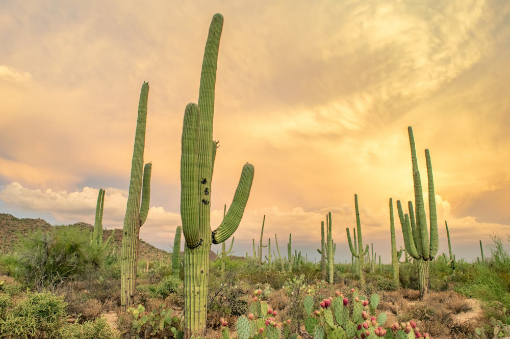
Not that long ago (in Earth time), during the last Ice Ages, the interior West was covered with multiple vast lakes, inland ‘seas’ that ranged from Montana to Arizona, and California to Utah. Some were found in the many flat basins that drained poorly if at all, particularly in one or more of what is today’s America’s four different deserts, the Great Basin, Sonoran, Chihuahuan, and Mojave deserts, as well as adjacent arid areas. Here, dozens of such lakes occurred in eastern Oregon, southern California, Nevada, Utah, and even southern New Mexico/ West Texas. Others were temporarily on dammed or blocked rivers, such as along the Columbia, the San Joaquin, the Williamette, and the Colorado.
Collectively, these vast great lakes of the west occurred in a different, wetter landscape and cooler climate, and spawned a huge abundance of wildlife including flocks of migratory waterfowl, furbearers like beavers and otters, and the now-phantom famous ‘mega-fauna’ species, such as the saber-toothed tiger, American lion, and dire wolf, the American camel, mammoths, giant ground sloths, and horses.
Early Humans
Today’s four deserts were then in an earlier stage of development and smaller extent. Early humans moved into the area and began hunting and settlements by perhaps 23,000 BP or so (according to recently discovered human footprints, preserved in the gypsum found along with some of the mega-fauna near White Sands NM, on the shores of former paleo-Lake Otero, then about 600-square miles in size, within today’s dry Tularosa Basin east of the Rio Grande).
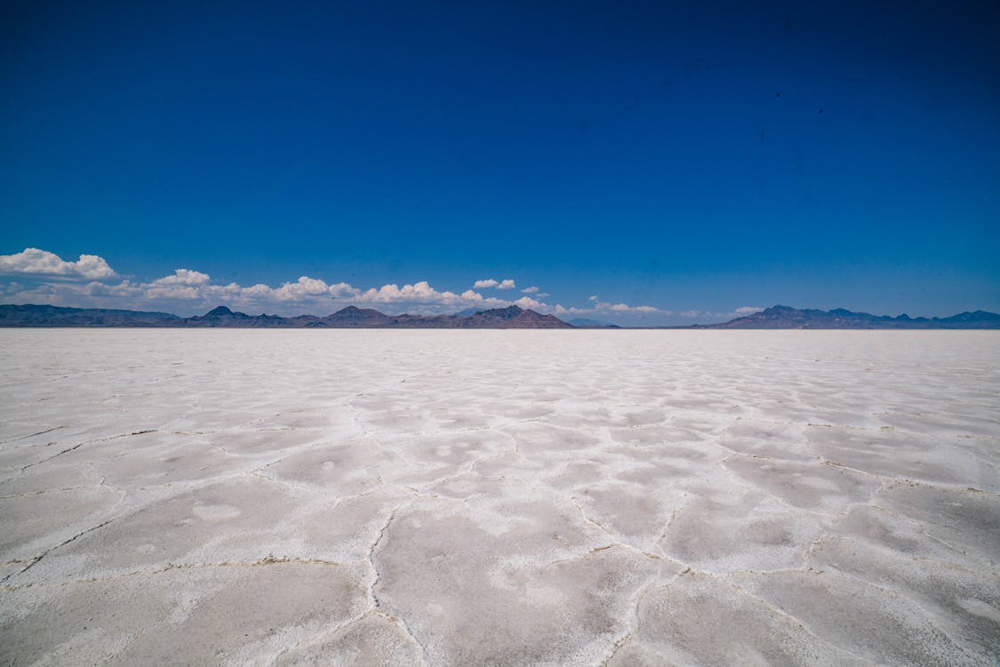
The two largest Western lakes were later called Lake Bonneville and Lake Lahontan. These vast bodies of water covered large portions of western Utah and western Nevada respectively. At about 85,000 square miles (53+ million acres), Lake Lahontan was the largest of two western paleolakes, while Lake Bonneville was about 20,000 square miles (12.5 million acres).
The Last Ice Age
As the last Ice Age ended and the climate warmed and dried, these once vast bodies of water shrank and began to assume today’s shapes and sizes. Some of these lakes disappeared, like the great mega-fauna of the times, while others shrank to fractions of their former size. Today’s Great Salt Lake in Utah is a remnant of Lake Bonneville, and at about 950 square miles, is only about 5% the size of the original, and much saltier. Now that the climate is again going through a major warming and, in the West, a drying shift, this and many other lakes have deeply threatened futures.
The lakes and their unique, fragile ecosystems are already threatened and vulnerable, and managing them is getting even more difficult. Not only have many of these areas historically supported an abundant diversity of migratory waterfowl, but many of them also support endemic fish species, uniquely adapted to warmer and saltier waters, species of trout, pupfish, suckers, and a diverse minnow family that occurs nowhere else. Nevada even supports a unique endemic family of fishes, the poolfishes, found in desert springs.
19th Century Settlers
When the area was first ‘explored’ and later ‘settled’ in the 19th century, it suffered from the opportunism and immense upheaval of a series of resource scrambles and grabs. Native American tribal rights were shoved aside in the name of Manifest Destiny and ‘Promised Land’ fever. First, the furbearers, mainly beaver and otter, were trapped out. The eastern Oregon area around Lake Malheur (‘misfortunate place’) was so named because it was low on furbearers. These populations were largely trapped out by the second half of the 1800’s.
In the late 1880’s, plume hunters searching for fashionable hat decorations began destroying the large flocks of bords. This was a time when ‘an ounce of breeding feathers was worth more than an ounce of gold’ (according to the Malheur National Wildlife Refuge brochure, USFWS), and there were no laws, ethics, or customs, written or unwritten, to moderate or restrain behavior. Hunters ravaged especially through the flocks of shorebirds and colonial nesting birds.
Meanwhile, wagon trains and settlers began moving into and through the area, pursuing gold and silver rushes, looking for religious freedom, to homestead, and in some cases to create cattle ranch empires on choice wide open and well-watered areas.
Water was the resource of utter necessity in this arid environment, and a primary key to future control and power. While technically renewable, water, as it falls from the sky, flows in springs and streams, or sits in lakes, is also extremely limited here. Deserts are generally defined as areas with less than 10” of rainfall per year. In the form of groundwater, deeper reserves are left over from Ice Age meltwater, and are not meaningfully renewable.
Where Did Our Water Go?
When the settlers arrived, they often claimed the water they needed from the limited supplies in the streams and rivers that fed the lakes. It was first come, first served, and those that claimed and used it first acquired senior rights under the Western water doctrine of ‘prior appropriations,’ first in time, first in line. People sometimes collectively claimed more than what there was, especially if it was claimed when more was available than there is now. Many streams were over-appropriated in this manner, much like the famous Colorado River example. The lakes, and their reliant natural communities and unique denizens, were naturally stressed.
🔥 Click here to compare 2026 prices & availability at the bottom of this review.
This situation has led us to today, where many lakes and streams that were already on a tight water budget, are now extremely stressed by the twin problems of human appropriation and climate change. Examples range from Mono Lake and Owens Lake in California, to Harney Lake and the Klamath Lakes in Oregon, to Pyramid Lake and Walker Lake in Nevada, to The Great Salt Lake and the Salton Sea in Utah and California respectively. Each situation has a different assemblage of issues and histories, but all are similar and have a similar set of possible, difficult solutions. A partial list of possible solutions is suggested below. Not all are applicable in all situations, and some may require legal changes that could take years if not decades. Still, it is clear that the current situation is not sustainable, especially if water supplies become tighter and the climate grows harsher. But it is clear that delaying attempts at solutions and simply hoping for the best is not going to work. And it is clear that money alone is not the answer, nor are gigantic expensive infrastructure approaches, as have often been tried in the 20th century and still today.
Following is a deeper look into the situations of two of the biggest lakes in the West – the Great Salt Lake and the Salton Sea.
The Great Salt Lake
The Great Salt Lake, the largest salt lake in the western hemisphere, has dropped 11’ and lost almost half its volume from when Utah pioneers first arrived in the valley. At an average depth of about 16’, there isn’t a lot of extra depth to drop. Each loss of one foot leads to a loss of about 150 square miles of surface area. Former islands in the middle of the water offered protected breeding sanctuaries from predators for some of the many bird species like white pelicans that stop over there, as well as for rare bighorn sheep. Now those lands no longer exist as islands, and can be attacked by coyotes, who now simply walk across the dry lakebed. Dust coming off the dry lakebed is called toxic, containing not only salts and fertilizers, but arsenic, creating health concerns.
It hit a low depth in 2021. The lack of water for the lake is caused by the twin problems of diversions – from one of the three streams that feed into the lake – and an historic drought, doubtlessly exacerbated by climate change. Yet there is still a new diversion and more dams under consideration, the Bear River project which could drop the lake level an additional 8.5 inches, exposing about 30 more square miles of lakebed. Opponents call it trading wetlands for lawns. “Utah is proposing to divert 25-30% of the Bear River, which is the primary water source feeding the American West’s largest remaining wetland ecosystem, the Great Salt Lake. The project is being pursued to provide municipal water to the Wasatch Front, most of which will be used on lawns. This $2.9 billion water project will divert 220,000 acre-feet of water out of the Bear River each year,” according to the Utah Rivers Council website. They say the project is proceeding mostly behind closed doors.
Meanwhile, billions have been poured into studying the lake’s situation and problems, with no real solution in sight. The lake itself pumps over $1 billion into the local economy each year, including from a brine shrimp ag fertilizer industry, waterfowl hunting, and tourism. Lake Owens, in California’s eastern Sierras, went dry in 1926, after Los Angeles diverted its supporting stream, and dried out an adjacent agricultural town. Now, however, the City has diverted about 5% of the water back into the lake as a dust mitigation remedy.
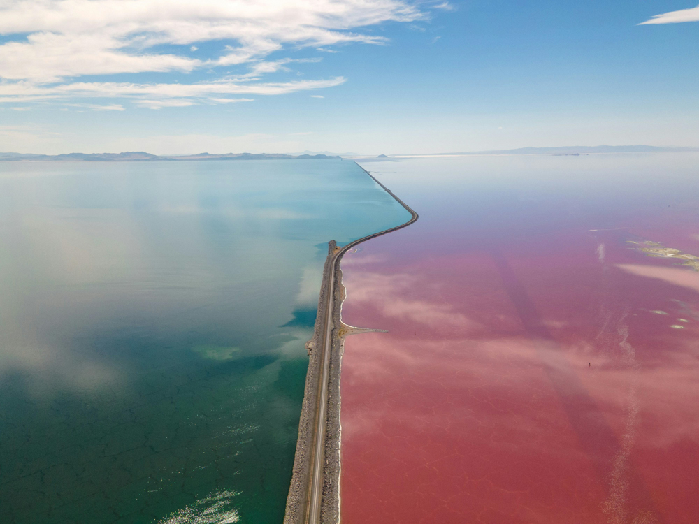
The Salton Sea

The Salton Sea is another fascinating case study. It is located near Coachella in the Imperial Valley, and atop the San Andreas fault itself. It too is a remnant of an Ice Age lake, Lake Cahuilla, which was once about 2,000 square miles in size, about six times the Salton Sea. The area flooded and receded periodically in the past as the nearby Colorado River flooded sometimes and as its delta built up and shifted over time. The area was dry until 1905, when a Colorado River flood, supplemented by high flows in the adjacent Gila Rover, overwhelmed diversion works under construction, and filled the low-lying basin, called the Salton trough, creating the modern ‘Sea.’ In the 1910’s, the Imperial Valley Irrigation District, organized and bought out a bankrupt California Development Company and, later, a handful of water companies, and exercised its senior water rights to establish a winter produce empire over about 500,000 irrigated acres. They now own the right to 2.6 million acre-feet of water. They would have dried out the lake except for this imported water.
By the 1950’s and 60’s, the Salton Sea had become a desert resort, visited by the likes of Frank Sinatra and the Beach Boys, and sported a wildlife refuge on its shores. It too was a major stopover for the Pacific Flyway. But the good times didn’t last long.
The problems began in the 1970’s. The lake began to dry up. Numerous plans were developed purporting to fix the problem, but none were carried out to success. Communities around the lake began to die out, like Bombay Beach, fish die offs occurred in the heavily stocked lake, triggered by algal blooms due to the heavy fertilizers entering the water, and toxic dust with a rotten egg smell began to blow, largely into the mostly Latino areas nearby. Under a 2003 agreement, the Irrigation District implemented conservation measures and diverted some water for 15 years back into the lake, as well as sending some to southern California cities. That agreement has ended now, and a ‘solution’ to the situation has not been reached. Suggestions for fixes include pumping water from the Sea of Cortez, (or Gulf of California), into the Sea, using geothermal resources to power the project. Meanwhile, the Irrigation District has fallowed about 10% of its lands, although its biggest crop is alfalfa, and about 1/3 of its hay is exported overseas to the Mid East and Far East, mostly for cattle production there.
It is difficult to see how some of these issues are going to be resolved without some significant give on the part of those who already have so much water that the individual systems cannot sustainably support themselves. But these high-minded ecological ideals are running smack into time honored ‘rights,’ hard business calculations, and ‘legacy’ ways of life. It really does seem to be an almost intractable situation, unless a new way of thinking takes hold. It reminds one of Albert Einstein’s saying that (to paraphrase), a problem cannot be solved on the same level of thinking as it was created.
Below are a partial set of ideas that may help to contribute to creative solutions.
Possible Solutions
- Establish in-stream water rights on streams and lakes
- Establish the Public Trust Doctrine for all streams and lakes
- Establish streams, lakes, and rivers as legal ‘persons’ with designated representatives
- Replace hydropower dams where possible with renewable energy configurations
- Use the Endangered Species Act and other environmental laws and regulations (for example, the Clean Water Act, or related to migratory birds) to establish better protection for those species
- Buy or lease water rights from agricultural operations or tribes
- Prohibit the use of precious limited water to grow crops for export in the case of threatened water resources
- Negotiate required water donations if lake or stream levels reach a ‘critical level’
- Involve the tribes more in creative, community-based solutions
- Promote nature tourism (e.g., birding)