
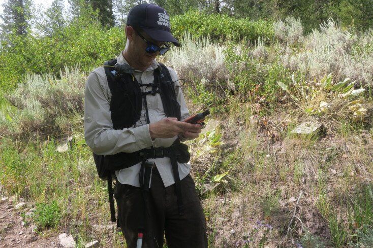
 Testing the Garmin inReach Explorer + in the Tetons | Photo Mountain Weekly News
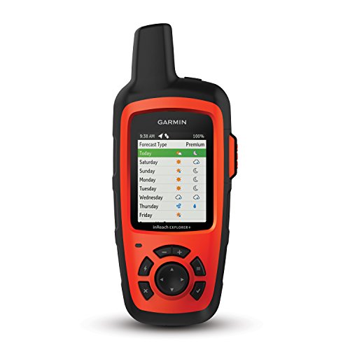
Stay in Touch from Anywhere with the Garmin inReach Explorer+
The Garmin inReach Explorer+ gives you enough functionality that it can be your go-to satellite communicator whether you’re an occasional through-hiker or a frequent backcountry adventurer.
That’s what the Garmin promises. But it also offers a lot more.
inReach Explorer Subscriptions

Depending on the satellite subscription plan you choose, you’ll get 10 minutes with the Safety Plan, 40 minutes with the Recreation Plan or unlimited ability to send and receive text messages each month with the Expedition Plan which we recommend.
Not only can you send and receive messages to your friends’ and family’s phones with it, but they can respond, too. This is one of the best features of this device. So if you need to chat, you’re available — even if you’re on the top of a mountain somewhere. You can also send SMS to email.
You can also use the inReach to trigger an interactive SOS, which alerts the GEOS monitoring team. They’ll notify emergency contacts and search and rescue first responders, share your locations, and keep you updated via text.
One thing to note is if you’re not on the Expedition unlimited texting plan and you go over your minutes, you’ll pay $0.50 per satellite messaging sent, which could add up quickly.
Garmin Explorer Topographic Map
By downloading GPS maps to your device, you can not only make sure you stay on track with your planned adventure, but also let friends and family know where you are. This is a great feature for backcountry adventurers. Even if you don’t send texts, your contacts can keep an eye on how things are going.
The topo maps included with the Explorer+ include on-screen GPS routing, as well as a digital compass, and barometric altimeter.
If you pair the device with your phone or tablet, you can also download maps from other sources, get NOAA charts, and download aerial imagery to improve your pre-adventure recon.
Multiple satellite subscription options

Do you go on tons of backcountry adventures where you’ll need a satellite communicator? Garmin has you covered.
Only go on one or two a year and don’t want to pay for all the extra features and constant up-time? No problem.
Garmin offers three levels of satellite plans (Safety, Recreation, and Expedition), and you can pay for all of them on a monthly or annual basis. If you don’t spend much time out of cell service, a monthly plan is the way to go. If you go all the time, you might be able to save some money with an annual plan.
🔥 Click here to compare 2026 prices & availability at the bottom of this review.
Here are the details on each level:
Garmin Durability
If all of these features sound like they might come in a fragile, high-tech package, you’ll be pleasantly surprised to find out that the entire thing is actually very solidly built.
It’s impact-resistant, water-resistant (up to one meter for 30 minutes), and packs a battery life that will keep it running for a long time:
- Up to 100 hours at 10-minute tracking intervals (the default)
- Up to 75 hours at 10-minute tracking with 1-second logging
- Up to 30 days at the 30-minute interval power save mode
- Up to 3 years when powered off
Even with all that, it’s only 2.7″ x 6.5″ x 1.5″, including a 1.4″ x 1.9″ screen. And at 7.5 ounces, it’s easy to make room for.
And it even comes with a carabiner for clipping it to your pack.
Weather Forecast
When you’re in the backcountry, you need to know what the weather is going to be like. Will it rain a bit? Or be a raging thunderstorm? Should you wear your warmest gear today, or pack it away for later?
There is even a variety of methods of sharing weather forecast info. You can get it on your phone, get text alerts, and sign up for basic or premium weather packages. (Check the cost table above for some of the details.)
Overall Impression
The Garmin inReach Explorer+ ($450.00) isn’t the most affordable satellite safety device. $450 is still a lot of money. You can pay less and get fewer features — but you could also pay several hundred dollars more.
The solid feature set and the ability to choose from a variety of plans on this inreach device and payment frequencies should suit anyone looking for a backcountry safety device. Especially if you don’t want to rely on your cell phone alone. The ability to track routes and waypoints is one of the better features of this Garmin devise.
Whether you really need a satellite communicator and SOS sender is up to you (though we certainly recommend it).
If you want to spend a bit less and you’re willing to forego some features, check out some of the other Garmin devices including the inReach Mini, which was featured in our list of the top five satellite messengers and personal locator beacons along with the inReach Explorer

Great review! The inReach Explorer Plus seems like an essential tool for adventurers. I love the idea of having two-way messaging and tracking capabilities in remote areas. It definitely gives me peace of mind when planning my next hike. Would love to hear more about your personal experiences using it!
Minnie,
We use the Garmin inReach ANY time we are out in the mountains. Most of the time it’s never actually used for emergencies, more so for tracking.
-Mike